


GeoReferenced Urban Landscape and Socioeconomic Indicators using Machine Vision
DataScouting and INFODIM have been granted the GRUBLES project, in the framework of the Action “RESEARCH – CREATE – INNOVATE”, which is co-financed by National (*) and EU Funds (**).
Innovation for better cities
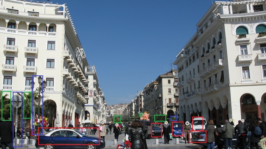
The aim of GRUBLES is to extract landscape and socioeconomic indicators of an area using machine vision on 360 degree photographs that can be captured through driving in the city. With the use of deep learning, GRUBLES will automatically process the images and identify features, such as trees, street lighting and lighting fixtures, trash bins, pavements, and cars. Those features will be correlated with secondary indicators, such as unemployment rates.
Creating better cities with technology
Collecting landscape and socioeconomic indicators is a very expensive process since it needs the local supervision of engineers or experts. DataScouting and INFODIM will try to automate this process with the use of machine vision and deep learning.
(*) National funds: Operational Programme Competitiveness, Entrepreneurship and Innovation 2014-2020 (EPAnEK) and National Strategic Reference Framework (NSRF)
(**) EU Funds: European Union, European Regional Development Fund


